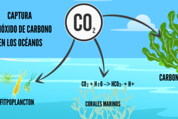
The algae monitoring project is an innovative and sustainable solution that uses satellite imagery and robotic technology to optimize the identification and management of areas with algal blooms. This approach is viable because it combines state-of-the-art technologies with the growing interest in harnessing algae to treat CO₂ and promote its cultivation in farms for various industrial applications. By using satellites, we can efficiently locate areas of algae naturally present in the sea, reducing the time and resources spent on manual exploration. In addition, the robot designed to monitor these areas offers a flexible, low-power option for collecting samples and measuring crucial parameters such as pH, temperature, salinity and oxygen level, allowing for accurate, real-time monitoring of the marine environment.

Data analysis and interpretation
In addition to collecting data, we take care of structuring it in an efficient way to facilitate its analysis. We apply advanced data processing techniques, allowing us to organize the information in a coherent and understandable way. This includes the interpretation of various parameters, such as water temperature, chlorophyll concentration, salinity, and other key factors affecting algal blooms.
The process of structuring and analyzing this data allows us to optimize the search for suitable areas for algae cultivation, improving accuracy and reducing the time spent on exploration. This approach not only streamlines decision making, but also maximizes monitoring efficiency, allowing for more detailed and dynamic monitoring of marine areas over time.
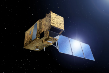
Satellite Images
Temperature Ocean

Chlorophyll map

0 Comentarios